Mesabi Trail Map: Biking The Iron Range
At 165 miles, the Mesabi Trail is the longest paved trail in the United States. Full of hills and turns, this mighty trail passes through 28 communities. To plan your ride, a Mesabi Trail Map is a must!
Free Mesabi Trail Map and Visitor Guide Makes Trip-Planning Easy
With a trail this long, and with so many things to see and do along the way, ordering a free Mesabi Trail map and visitor guide can go a long way toward ensuring a great experience. Whether you start in Grand Rapids in the west, Ely in the East, or spend all your time right on the Minnesota Mesabi Iron Range between Hibbing and Embarrass, you’ll find incredible views of lakes, active mining, rivers, wetlands, woods, parks and much more.

Discovering the Hidden Gems on the Mesabi Trail
With 28 northern Minnesota towns to explore, places to learn, explore, eat and rest are everywhere! The Mesabi Trail map, along with visitor guide, will provide more information, but here are a few of our favorites:
Greyhound Bus Museum: If you love Americana, you’ll love this museum that is all things Greyhound Bus Co.! The museum commemorates our nation’s first city-to-city bus service, founded in Hibbing! You’ll be amazed at how bus travel, once the most popular form of transportation, was revered! Tip: This building and parking area in Hibbing is a Mesabi Trail trailhead.
Bruce Mine Headframe: This lovely rest area right on the Mesabi Trail in Chisholm is the site of the last remaining headframe on the Mesabi Iron Range. Built in 1925-26, it is the structure that lowered elevator cars into the underground Bruce Mine until the 1940s. Tip: this area serves as a Mesabi Trail trailhead with parking.
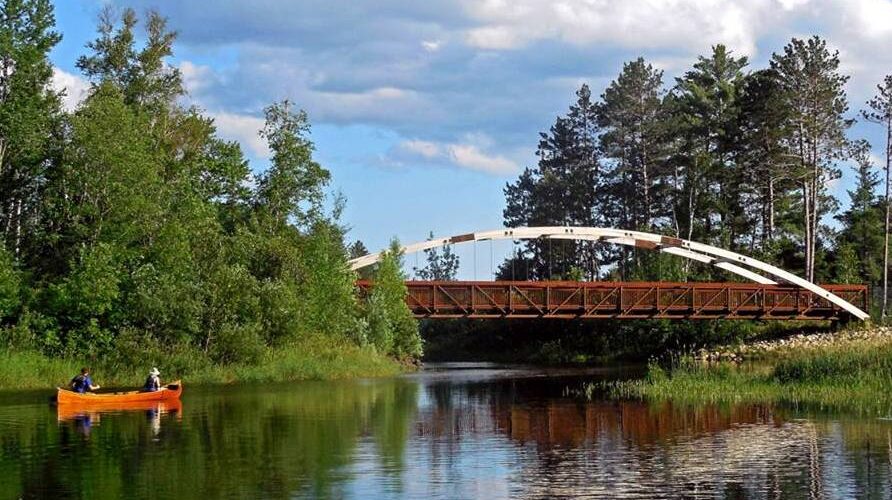
BridgeView Park: The Tom Rukavina Memorial Bridge in Virginia stands 200 feet above the former Rouchleau Mine, and the Mesabi Trail goes right over it! Along the way to or from the bridge on the Mesabi Trail, you’ll pass by Bridge View Park. Be sure to learn about the construction of this bridge, and this history of the mine. It’s a great photo op, too!

Once You’ve Got Your Mesabi Trail Map, A Wheel Pass is Next
Don’t forget to purchase your Mesabi Trail Wheel Pass. Vendors all along the route sell the Wheel Pass, which is only $10 for three days or $20 for an annual pass (good for calendar year). Some handy lodging properties and campgrounds sell the pass onsite. Here are a few of them: Chisholm Inn and Suites, Comfort Inn and Suites of Mountain Iron, AmericInn in Virginia, Eveleth Super 8, and Sherwood Forest Campground and West 40 RV Campground, both in Gilbert. The Mesabi Trail actually goes right by Sherwood Forest and passes near West 40. Access to bike trails is easy from the Eveleth Super 8, Chisholm Inn and Comfort Inn and Suites.
Wheel Pass vendors, mileage, elevations and trailhead sites are all listed on the Mesabi Trail Map, so order your free copy today! Insider Info: A paper map will go a long way to helping you plan! Remember, this trail is 165 miles long and goes from the Mississippi River to the Boundary Waters – you need to see it to make the most of your experience.
Traveler Tip: Consider Bringing All Your Bikes!
Did you know Minnesota’s Mesabi Iron Range is home to some of the best mountain biking in the country? Explore 20+ miles at Redhead Mountain Bike Park, right off the Mesabi Trail. Bike rentals and bike shop onsite at the trailhead.


