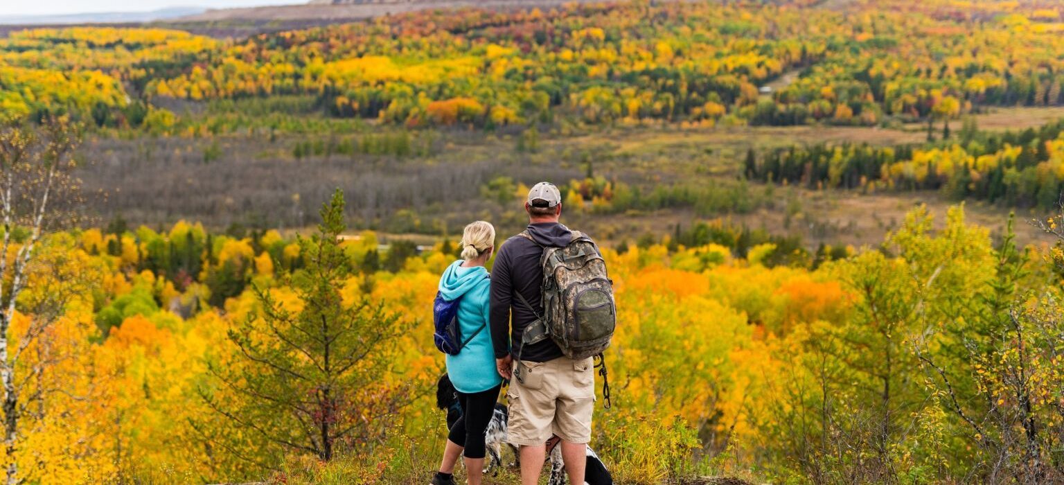
Superior National Forest
Nearly half of the land that stretches across the Iron Range is designated Public Land. The arrowhead region of Northern Minnesota is home to the Superior National Forest’s 3 million acres of a spectacular variety of trees, rocks, and water. Here you will find the perfect setting for your outdoor activities.
The lakes and rivers found in the midst of the Superior National Forest provide the perfect opportunities to see wildlife in their prime habitat. The abundance of the boreal forest’s wildlife range from birds to bears, moose to muskie, and wolves to walleye.
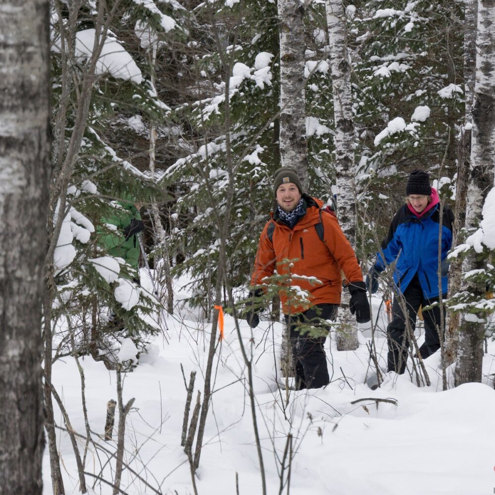
The public land is cared for by the DNR and US Forest Service. There are hiking trails that are suitable for all levels of hiking skills. If you are looking for places to go camping, fishing, swimming or boating this is the place for you. This all-season treasure welcomes hikers, hunters, and fishermen year-round. Whether you hunt grouse, deer, or waterfowl – or are simply looking for photo opportunities – there are thousands of acres available for you to find the Perfect Spot.
Our Hiking page will connect you with the perfect opportunity for all outdoor enthusiasts.
Explore the Superior National Forest
Thea Great Divide
Location: Superior National Forest- Laurentian Divide/Lookout Mountain, Approximately 10 min north of Virginia
Trail Length: 0.5 miles – 14 miles
Tips: Bring a camera to snap a picture of the extensive trail system map at the trailhead and to capture the stunning views from Lookout Mountain. Hiking boots are helpful for the occasionally muddy patch.
Just north of Virginia off of Highway 53 is the Superior National Forest’s Laurentian Divide. The parking lot is visible and easily accessible from the highway, making it a perfect spot for a quick outing or a full-day adventure. The Laurentian Divide offers something for everyone.
A short half mile fitness trail has workout stations featuring pull-up bars, balance beams, crunch benches, and more. Geology aficionados will appreciate the Laurentian Divide’s geological and historical significance. This area is a continental watershed, meaning water north of here flows through Canada and eventually ends up in the Hudson Bay, while water south of here flows down into either Lake Superior or the Mississippi River. Several signs around the trail entrance share details about the formation of the area.
In early spring, the ground is too soft for mountain bikers, but later in the year you’ll see bikers traversing the hand-built mountain bike trails maintained by volunteers through the Iron Range Off-Road Cyclists.
The extensive trail system has over 14 miles of well-marked walking trails. Lookout Mountain is the most popular hike, with scenic treetop views. You can take several different routes to access Lookout Mountain. Wooded trails weave to the top or you can take the access road as a shortcut to the lookout. This is one of the best views of the expansive Superior National Forest.
Tips: Bring a camera to snap a picture of the extensive trail system map at the trailhead and to capture the stunning views from Lookout Mountain. Hiking boots are helpful for the occasionally muddy patch.
Bird Lake
Just east of Hoyt Lakes, the 12-mile Bird Lake trail system is great for hiking and cross-country skiing alike. Select a section of the trail or try the entire route. The scenery includes lakes and gentle hills, wetland areas and woods. You’re unlikely to pass anyone, or be passed along the way!
Big Aspen
North of Virginia, not far off of Hwy 53, Big Aspen trails are a series of 21 miles of looped trails with a great overlook. These trails are shared by hikers, mountain bikers and ATVs in summer and fall, and cross-country skiers in winter.
Superior National Forest Campgrounds
The Superior National Forest has outstanding camping experiences throughout the Iron Range’s 3 million acres of wilderness. You’ll find developed campgrounds with waterfront sites perfect for fishing, family-friendly amenities, and modern facilities that accommodate both tents and RVs. Check out our list of recommended camping locations!
For the more adventurous, dispersed camping allows you to set up in secluded wilderness spots where you can truly disconnect from civilization.